The FIG Working Week 2025 / Locate25 event is almost here, and the focus is on the future.
The combined FIG Working Week 2025 and Locate25 conference is about to begin, bringing with it a program of presentations and activities of a scope not seen in Australia for more than a decade.
The event’s theme — Collaboration, innovation and resilience: Championing a digital generation — will be underlined by a sub-theme of the challenge of climate change, and ways in which the geospatial community can assist the wider global community to meet that challenge.
The conference could not be more timely. According to the President of FIG, Diane Dumashie, “In recent years, several transformative forces have converged, compelling our profession to redefine how we create, deliver, and communicate value within the context of sustainability”.

“Awareness of trends and megatrends fosters preparedness and is the first step towards resilience; however, the next and immediate step in this decade demands action,” she added. “The digital age will propel us forward, underscoring the urgency to act now.”
“But for surveyors to remain relevant and maintain our international impact while providing services not only to our members but also our global partners, we will need to be collaborative, innovative, and our actions be sustainable in the face of the climate imperative,” she said.
High-level plenaries
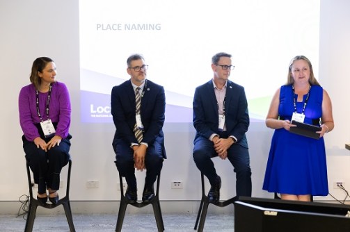
Collaboration and innovation will be highlighted during the plenary sessions, which will be held on the mornings of Monday the 7th, Tuesday the 8th and Wednesday the 9th of April. Bringing together top-level professionals from across the globe, these sessions will set the tone for the entire conference by focusing in on the event’s climate and digital themes.
The Monday plenary will encompass the physical features of the Earth and its atmosphere, as well as human activity and resources. To be chaired FIG Vice President Qin Yan, from China, the first presentation, on the topic of Geography and the Geospatial Ecosystem: Enabling Opportunities for a Digital Generation, will be led by Australia’s Greg Scott with contributions from Naa Dedei Tagoe (Ghana), Dr Li Pengde (China), Head of the UN-GGKIC, and Linda Foster (USA).
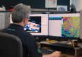
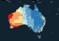
This will be followed by the Ignite Presentation, presented by Lisa Bush from Geoscience Australia. Her plenary will address the topic of From silos to synergy: Building Australia’s first national geospatial information ecosystem with the Digital Atlas of Australia.
Tuesday’s plenary will have a climate focus and will challenge participants to rethink core assumptions and established norms, and consider how to future-proof practices and standards. Chaired by FIG Vice President Winnie Shiu (USA), it will feature four presenters:
- Siobhan McDonnell (University of Canberra): Rethinking gender and climate change: implications for land use planning and resettlement
- Viliami Folau (Director of Surveying, Tonga): Resilience through Land Management: Linking Land, Climate and People
- Michael Manikas (General Manager, DLG SHAPE, Australia)
- Geoff Smith (Australian Spatial Analytics): Unlocking enormous potential: the neurodiverse geospatial workforce revolution

The third and final plenary session will deal with the professional standards, competencies, training and skills that will keep the geospatial sector relevant in a world of transformation and ever-changing technologies. Chaired by FIG Vice President Michalis Kalogiannakis (Greece), the session will feature:
- Stamatis Kotouzas (World Bank)
- Professor Matt King (Australian Centre for Excellence in Antarctic Science): Ice Sheets and Future Shorelines: The Necessary Geodetic Revolution
- Melissa Harris (Geoscience Australia)
- Allison Craddock (Geodynamics and Space Geodesy Group, JPL): Where am I? Unlocking the Power of Geodesy with International Collaborations
- Professor Anthony Yeh (The University of Hong Kong, HKSAR China): Big Data and Smart Cities
- Andrew Dowding (Winyama): Digital Mapping for Cultural Knowledge: Building Indigenous Data Sovereignty
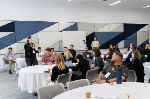
Getting technical
Following each day’s plenary sessions, the technical program will begin. Broken into 8 to 10 separate subject streams, the topics to be covered will include:
- Professional standards and practice
- Professional education
- Spatial information management
- Hydrography
- Positioning and measurement
- Engineering surveys
- Cadastre and land management
- Spatial planning and development
- Valuation and the management of real estate
- Construction economics and management
All up there will be eight technical sessions spread across three days from Monday to Wednesday.
Several technical tours have been arranged to give locals and international visitors alike the chance to see first-hand how Australian geospatial professionals are operating at the cutting edge of emerging technologies and research. One such tour will be an expert-led walking tour through the Brisbane CBD to see how the city is preparing its infrastructure for the upcoming 2032 Olympic Games.
Another tour, presented by senior Queensland Government geospatial experts, will provide participants with a detailed look at aspects of surveying, spatial and land administration matters in the state, including policy and legislation, native title, and Queensland’s groundbreaking Queensland Globe.
Tours will also be available through the state’s remarkable Museum of Lands Mapping And Surveying, which houses an incredible collection of surveying artefacts and maps that stretch back more than a century and a half.
For those who like getting out on the water, short forays will be provided aboard the QG Norfolk, a 19-metre-long hydrographic survey vessel that is equipped with state-of-the-art echo sounding technology. There’ll be four, 30-minute tours per day across Tuesday, Wednesday and Thursday.
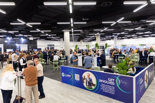
Finally, for those who like to get their hands on the latest and greatest geospatial technologies, the exhibition hall will be packed with stands representing Australian and overseas companies and organisations.
FIG Working Week 2025 and Locate25 promises to be a not-to-be-missed event. It’s not too late to register — head to fig.net/fig2025/registration.htm for full details.
FIG Young Surveyors Conference
The 9th FIG Young Surveyors Conference will run across two days, Saturday, 5 April and Sunday, 6 April, and will be held in The Cube at the Queensland University of Technology campus just across the river from the main conference venue. The Cube is one of the world’s largest digital interactive learning and display spaces.
In keeping with the digital theme of the wider conference, many of the sessions and presentations within the Young Surveyors Conference will focus on how young professionals can and should be empowered to shape the ‘digitally enabled future’ of the geospatial sector.
Presented by the FIG Young Surveyors Network and GCA Young and Emerging Professionals, it will feature presenters from Australia and around the world, including representatives from academia and private industry, with plenty of time set aside for mingling and networking… including a Meet an Expert ‘speed dating’ session where young professionals will get the chance to sit and chat with senior geospatial professionals.
More details: fig.net/fig2025/youngsurveyors.htm
Reference Frame in Practise Seminar
A number of important meetings will be held of the sidelines of the main conference, including the Reference Frame in Practise Seminar, which will take place on Saturday, 5 April, and Sunday, 6 April. Bringing together some of the world’s leading geodesists and geodetic surveyors, the seminar will focus on the need for modern reference frames. In particular, the meeting will address reference frames as they apply to the needs of UN initiatives and regional requirements.
Specific topics to be covered included dynamic datums, deformation models, geoids and CORS, and there’ll be special sessions focusing on developments in the Asia-Pacific… with a particular emphasis on the Pacific Islands and Papua New Guinea.
More details: fig.net/fig2025/rfip.htm